Looking for the best day hikes in Scotland? From epic Munro climbs to scenic coastal walks, these hikes are suitable for a range of difficulty levels!
It’s no secret that Scotland is a hiker’s paradise. From rugged mountain peaks to vast moorlands and mirror-like lochs, it’s a country of dramatic, windswept beauty that offers an unforgettable experience for any nature lover.
And the best bit? You don’t even need to go far to get right in the middle of it all. You can get a taste of Scotland’s beauty in a day hike. The only real problem is deciding where you want to walk!
Here’s where I can help. In this guide, I’ve rounded up the best day hikes in Scotland, ranging from easy to challenging. To put it together, I’ve asked fellow travel bloggers and local experts to share their own favourite walking trails.
The best day hikes in Scotland
This guide goes beyond national parks to cover walks in the Scottish Isles, Scottish Borders and even Edinburgh!
Check out this map below to find out where they’re located, then scroll down to discover the best hiking in Scotland you can do in a day!
1. Old Man of Storr, Skye
By Paulina from ukeveryday

Route length: 3.8km (2.3 miles)
Hike duration: 1 hour 15 mins
Hike difficulty: Easy-moderate
Highlights: Epic scenery | Island views | Ancient landslide
Hikes on the Isle of Skye are considered one of the most scenic in the UK. If you are looking for a relatively easy walk with beautiful views, choose the Old Man of Storr on the Trotternish Peninsula!
Massive rocks that rise above the ground attract many photographers from all over the world to take incredible pictures in the Scottish Highlands.
It takes only one hour and 15 minutes to get close to the impressive rocks and come back, which makes it a great hike regardless of your fitness level.
The best time to do a hike is in the morning to avoid crowds or just before the sun goes down. This is a dream location for taking amazing photos of the sunset in Scotland.
The Old Man of Storr offers incredible views of rock formations and surrounding Scottish islands such as Rona or Raasay.
It’s also a famous movie location which you can see in Prometheus and it’s not surprising that such a place was chosen as a science-fiction film location.
It looks out of this world and shouldn’t be missed when visiting Scotland!
Where to start the hike: You can start The Old Man of Storr hike from the car park which has plenty of spaces, including for campervans. This location offers an incredible day out in the Scottish Highlands.
Read More: Isle of Skye 2 Day Itinerary: Amazing Things To Do
2. Sea Stacks, John O Groats
By Peter Tyron from The Backpacking Family

Route length: 4km (2.4 miles)
Hike duration: 1 hour
Hike difficulty: Easy
Highlights: Coastal views | Lighthouse | Sea Stacks | Most northerly point on the UK mainland | Puffins (depending on the season)!
For a stunning stroll in Scotland visit the Sea Stacks of Duncansby at John O Groats. This is the perfect hike if you are doing the North Coast 500 road trip or just visiting John O Groats.
This is one of Scotland’s easier hikes. The terrain is relatively flat and there are good footpaths in the area. Navigation is pretty easy – just follow the coast down and then back up the same route. The full walk by the Sea Stacks is around 2km each way.
It is likely to take around one hour plus stopping time. Keep an eye out for Puffins perched on the cliffs in this area (from May to July).
Remember to bring an extra layer or two as this area is very exposed and cold most of the year. Be aware that the weather can also change very quickly here.
If you are in the area don’t miss John O Groats village – the most distant point from Land’s End, Cornwall. Also, check out Dunnet Head – the most northerly point on the UK mainland.
Where to start the hike: It starts at Duncansby Head car park near the lighthouse. From here, follow the trail south along the coast. A short walk and you should get amazing views of the spectacular Sea Stacks.
3. Kelso to Jedburgh, Scottish Borders
By Heather Cole from Conversant Traveller

Route length: 20km (13 miles)
Hike duration: 4 hours
Hike difficulty: Moderate
Highlights: Kelso Abbey | Tweed and Teviot Rivers | Castle ruins | Roxburgh Viaduct | Jedburgh Abbey
You don’t have to hike up a mountain to be able to experience some of Scotland’s best scenery.
Down in the Scottish Borders, there are plenty of walking routes that take in beautiful landscapes, as well as culture and history. The best time to visit the area is between spring and autumn when the weather is milder.
The Borders Abbeys Way is a long-distance circular hike, taking in the four famous abbeys and lasting around 6 days. However, you can break it down and do sections of it as a day hike for an equally rewarding experience.
One of the prettiest legs is the Kelso to Jedburgh part, and this particular walk is one of the most popular activities in the Scottish Borders for nature lovers and hikers.
Where to start the hike: Start in Kelso, where the historic abbey can be visited for free. Continuing the walk, you’ll meander beside the Tweed and Teviot Rivers, where salmon leap and otters can sometimes be spotted.
Next, you’ll pass by the royal castle ruins and viaduct at Roxburgh before hiking along a section of the original Roman road at Dere Street. The trail ends in Jedburgh, where another Border abbey awaits.
This walk is of medium difficulty. It’s 20km long, but the terrain is easy underfoot, mainly using riverside paths and tracks, and the total ascent is only 330 feet.
There’s a regular bus service between Kelso and Jedburgh, so it’s easy to travel between the two places before and after your walk.
Read More: Hotel Review: Schloss Roxburghe, The Scottish Borders
4. Ben Hope, Sutherland
By Maja Proescholdt from Away With Maja

Route length: 7.6km (4.7 miles)
Hike duration: 4-5 hours
Hike difficulty: Hard
Highlights: Most northern Munro | panoramic views from the summit
Ben Hope is one of the most unique day hikes in Scotland. Located in Sutherland, this is the most northern Munro (mountains over 3,000 feet) in Scotland.
It’s a can’t-miss stop if you’re travelling along the famous North Coast 500 route.
Ben Hope is 927m high, and easily recognizable as its peak stands alone from the other surrounding mountains and hills.
The route is 7.6km, but don’t let that fool you: it’s a hard hike and a steep ascent as you’re walking straight up the mountain. It’s one of the best day hikes in Scotland for those who like a challenge.
The hike will take between 4-5 hours to complete, and it’s best to do it on a clear day when you’ll get a view.
Keep in mind that mountain hikes in winter and shoulder seasons often require additional gear, such as crampons and an ice axe, and the knowledge of how to use them safely.
Hikers without winter mountaineering skills should aim to do this walk in spring, summer, or autumn. The best part of hiking Ben Hope? Seeing the phenomenal views from the summit.
In good weather, you can see for miles – out over the lochs and hills of Sutherland to the sea, and inland over the Strathmore River.
Whether you’re doing the North Coast 500 or not, this is a one-day hike not to be missed in Scotland.
Where to start the hike: The most direct way starts near Dun Dornaigil broch in Strathmore. Here, you’ll be going up the south side of the mountain.
You’ll know you’re in the right place as there’s a car park which marks the beginning of the Ben Hope hike.
5. Ben Nevis, Fort William
By Rachel from Average Lives

Route length: 17km (10.5 miles)
Hike duration: 7-9 hours
Hike difficulty: Hard
Highlights: Highest UK mountain | Views of the Scottish Highlands
Ben Nevis is easily one of the best day hikes in Scotland, and 125,000 people climb it every year. The mountain forms part of the Grampian Mountains’ Nevis Range near Fort William.
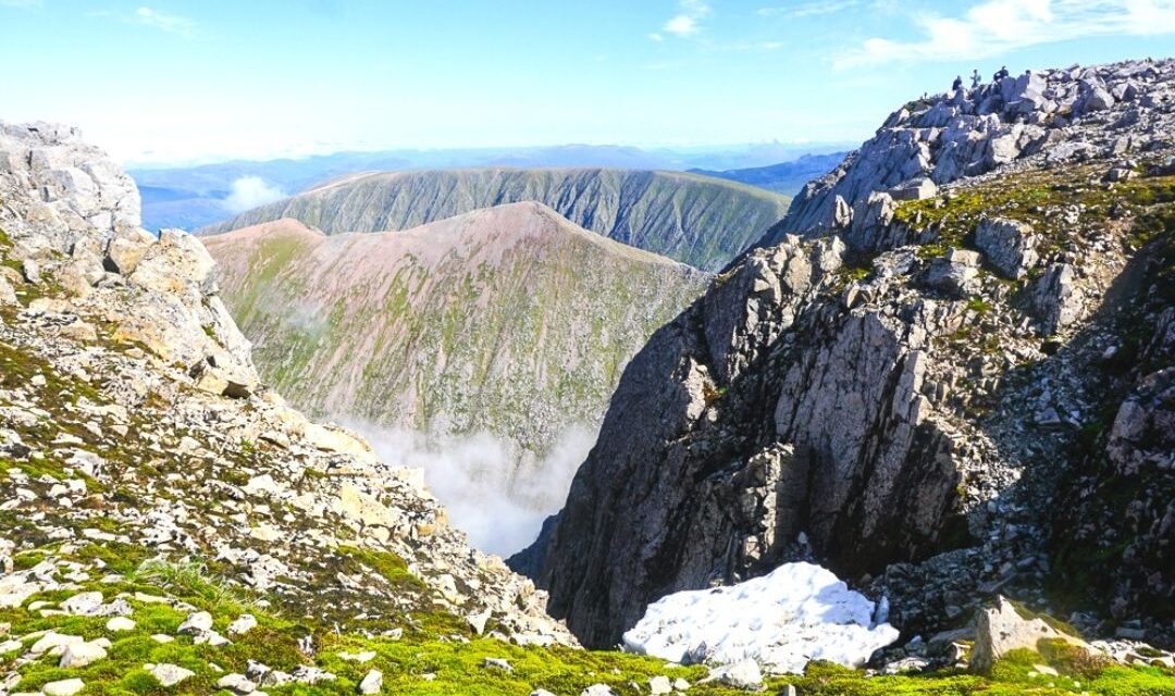
It is the highest mountain in the UK at 1345m, and if you visit on a clear day, you will have an exceptional 360 view over the highlands. At the top, there is a cairn and an old observatory used today as a shelter.
The best time to climb Ben Nevis is June to September, when the weather is warmer because, in the winter, there will be snow and ice, which would make the route more challenging.
However, summer is when the mountain is the busiest too.
It will take about 7-9 hours to conquer the mountain and usually takes people around three and a half to four and a half hours to reach the top. The total distance is 17km (10.5 miles).
The hike’s difficulty will depend on your fitness level and experience climbing mountains, but it isn’t easy, and you should train for it. Also, a good tip is to bring some midge spray along with food, water, and layers.
Where to start the hike: There are several routes to the top of Ben Nevis. The easiest way is the tourist track, a zig-zag path. The starting point is the Glen Nevis Visitor Centre car park.
Alternatively, the Carn Mor Dearg Arete route is a dangerous and challenging ridge walk.
Read More: 10 Best Fort William Day Trips: Hikes, Castles And Epic Train Journeys
6. Corrie Fee & Glen Clova Munros, Angus
by Kathi from Watch Me See

Route length: 7.5km (4.7 miles)
Hike duration: 2-2.5 hours
Hike difficulty: Moderate
Highlights: Nature reserve | Munros | Lochs | waterfalls | castle ruins
The Angus Glens are among the best-kept secrets in the Scottish Highlands and easily one of the most beautiful hikes in Scotland.
Nestled on the southern edge of the Cairngorms National Park, these six glens from Glen Isla in the west to Glen Esk in the east are a hiker’s paradise.
Lochs and waterfalls, castle ruins and Munros – that’s Scottish mountains over 3,000 feet – they have it all.
Arguably the most beautiful among them is Glen Clova, a valley filled with pine trees and framed by mountains.
A popular hike here at Glen Clova is the walk to Corrie Fee Nature Reserve. The bowl-shaped corrie was formed by the movement of glaciers and looks like a natural amphitheatre.
Nature is the star of the show here as the corrie is home to rare plants, alpine flowers, eagles and butterflies. The path runs alongside a meandering river and there is a stunning waterfall at the far end.
Hikers who are looking for a bigger challenge can climb up beside the waterfall and onto the Cairngorms plateau. From here it is a moderate hike to one or two Munro peaks, Mayar and Driesh.
The entire loop takes about 5-6 hours and is best done during the summer, as winter conditions can be harsh in the Cairngorms.
The Glen Clova Hotel is the perfect place to ring out the day with a meal or a drink.
Where to start the hike: The easy hike from Glen Doll Ranger Station takes about one hour and for most of the way, it follows a wide forestry track.
Read More: Discover Your Perfect 10-Day Scottish Highlands Itinerary
7. Conic Hill, Loch Lomond
By Kat from Wandering Bird

Route length: 5.1km (3.2 miles)
Hike duration: 2-3 hours
Hike difficulty: Moderate
Highlights: Views of Loch Lomond and the Trossachs National Park
If you’re looking for an easy day hike near Loch Lomond in the west of Scotland, head to Conic Hill. This hike is pretty short, and fairly easy for people of most ages and abilities and yet boasts some incredible views from the top of the hill.
It’s part of the famous West Highland Way, which is a much (much!) longer route, but this is a great snippet for a day out.
Dogs technically must be kept on a leash, but you’ll see plenty of them running free.
The path is mostly gravel and quite wide, winding its way through a beautiful forest. Steps are cut in where it climbs.
Once you leave the forest, you’ll be blown away by the incredible views over the loch and the hills around.
The top part is pretty steep, but take your time and I promise the views are worth it. Even better, on the way back down you’re facing the loch, so you can enjoy those views as you head back to the car park.
The total route is around 5.1km and it’s probably a ‘moderate’ climb, as some sections are quite steep. Plenty of kids climb it though without any problems.
Where to start the hike: Park at Balmaha Car Park (there’s a tourist information centre there) and plenty of parking, even if you’re in a larger vehicle or are campervanning in Scotland, although you might want to get there early in summer to guarantee a spot.
8. Bay of Skaill to Birsay, Orkney
By Suzanne from Meandering Wild

Route length: 12.8km (8 miles)
Hike duration: 5 hours
Hike difficulty: Easy-moderate
Highlights: UNESCO World Heritage site | Cliff views | Birsay village | Lighthouse
This walk is part of the longer St Magnus Way that runs from Egilsay to Kirkwall where St Magnus Cathedral stands and the West Coast Walk on Orkney from Stromness to Birsay.
Above Marwick Bay is the Kitchener Memorial. All along the cliffs, you will see nesting birds during the summer.
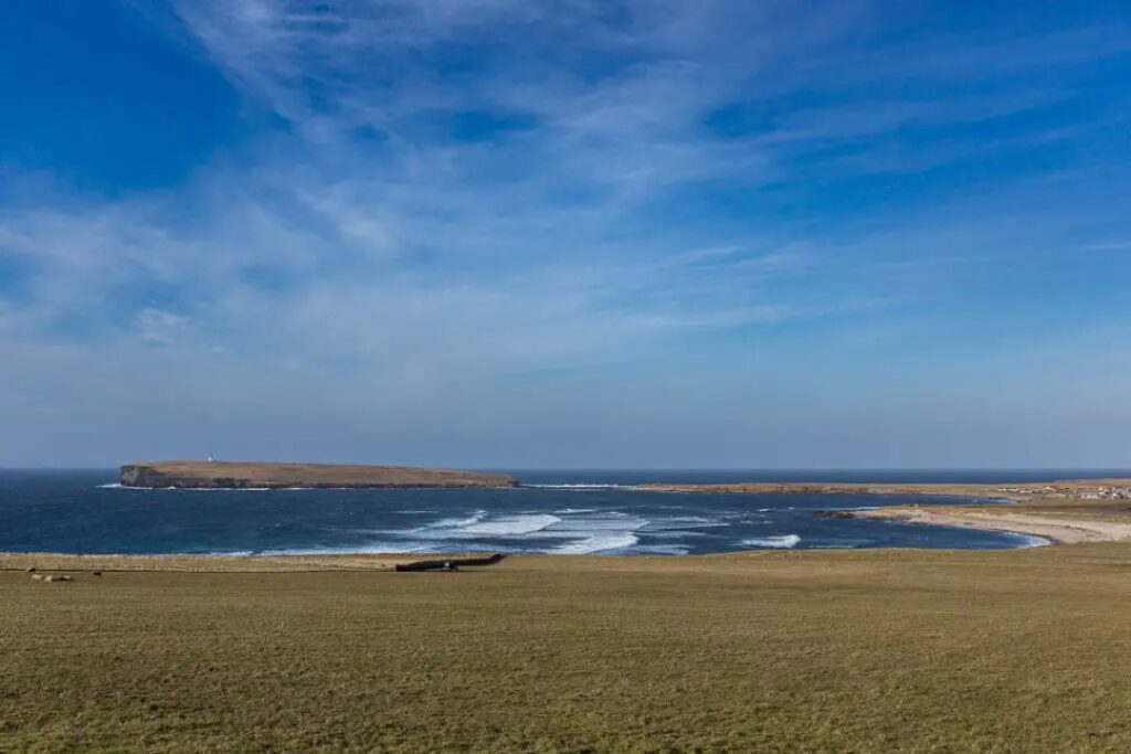
From the Kitchener Memorial, you will be able to see Brough of Birsay with the lighthouse where the walk ends. The village of Birsay also has the ruins of a Bishop’s Palace and a small café.
This is a moderate hike following the coast with a few sections of steeper grass paths. It switches between coastal path and road although the roads are exceptionally quiet.
It’s a linear walk so it will need to be planned around bus timetables. The 8S runs from the Skara Brae Visitors Centre to the Community Centre in Birsay.
Visiting the lighthouse on the Brough of Birsay can only be done on either side of low tide so again planning is needed.
Where to start the hike: The hike starts at the UNESCO World Heritage site of Skara Brae, an ancient Neolithic village that is fairly intact.
It then follows the coast to Marwick Bay with the remains of a shipwreck washed up onto the pebble beach.
The hike is 12.8km and will take five hours with time for stops. It should not be attempted in windy weather as the cliffs are high and exposed.
9. The Cobbler, Loch Lomond
By Kat from Biker Girl Life

Route length: 11.2km (7 miles)
Hike duration: 4-6 hours
Hike difficulty: Hard
Highlights: Views of Loch Lomond | Mountain hike | Rock climbing (optional)
The Cobbler is one of the best day hikes in the Arrochar Alps and a great choice for anyone wanting a bit of a challenge.
Found in the middle of the Loch Lomond National Park, the mountain is actually called Ben Arthur, but it’s affectionately known as the Cobbler due to its distinctive appearance.
It’s a longer hike than many in the area, but still perfectly doable in a day. In good summer conditions, it takes people with a good degree of fitness 4-6 hours to complete and is about an 11.2km loop.
There’s an easy-to-follow path with steps built in and signposts for those with less experience, but the hike is famous for its rock climbing and you’ll see plenty of people traversing the eastern face.
In winter, you’ll need crampons and full climbing gear to rock climb safely.
Do not underestimate the mountain- it may be smaller than others around it, but you still need to pack and prepare appropriately.
It’s possible for it to be sunny at the foot of the mountain, but still have snow and ice at the top.
Be sure to check the weather as things can change very quickly in the area and you don’t want to get caught out.
Also, it’s almost always windy up at the top, so definitely bring a warm jacket, even if you don’t think you’ll need it when you’re standing at the bottom.
Where to start the hike: The best place to park is in Succoth and there’s plenty of parking available if you’re driving or motorcycling in Scotland. That’s where you’ll find the start of the trail too.
There are three trails to the summit, so pick the one which best suits your ability and needs.
10. Nevis Gorge to Steall Falls, Fort William
By Cecily Protsack from Groovy Mashed Potatoes

Route length: 3.5km (2.1 miles)
Hike duration: 2 hours
Hike difficulty: Moderate
Highlights: Nevis Gorge | Scotland’s second-largest waterfall
Fort William, the adventure capital of the UK, is known for having some of the most spectacular hiking trails in the country.
Since the region has the highest mountains in Scotland, many hikes in the area are difficult with high ascents. This isn’t the case, however, with the walk through Nevis Gorge to Steall Falls, making it one of the best day hikes in Scotland.
The 3.5km hike is moderate with a total ascent of 220m. It’s one of the prettiest trails in the region, first taking you through a rugged forest along Nevis Gorge until you reach green expansive meadows with views of Ben Nevis and its surrounding peaks.
As you walk along the grassy meadows, you will see Scotland’s second-highest waterfall, Steall Falls in the distance. You can walk right up to it from the big boulders below.
The best part of the hike is having a picnic by the creek nearby in the grass. If it’s a hot day, take a refreshing dip in the creek.
Where to start the hike: To get to the trailhead, take the scenic drive to the end of Glen Nevis Road to the Upper Glen Nevis Car Park.
You will see why it’s one of the best regions to do a Scotland road trip. The drive takes about 20 minutes from Fort William. Give yourself two hours to complete the hike.
11. The Merrick Trail, Galloway Hills
By Alex from Just Go Exploring

Route length: 14km (9 miles)
Hike duration: 5-7 hours
Hike difficulty: Moderate-hard
Highlights: Lesser-known hike | Epic views | Bruce’s Stone
Wild, rugged, and incredibly beautiful, Galloway Forest Park, in the southwest corner of Scotland, has many excellent walks and hiking trails. One of the best of these is the Merrick Trail.
The Merrick is the highest peak in southern Scotland and forms part of the Range of the Awful Hand. This mountain attracts a fraction of the number of hikers compared with some of Scotland’s better-known peaks.
Those who do come here are rewarded with fantastic scenery and a hike that’s much less crowded than the country’s more famous trails.
The Merrick trail is fairly challenging, steep and rocky in a few places, and requires a reasonable degree of fitness.
In total, the distance from the start point to the summit and back again is 14 kilometres (9 miles), gaining over 850 metres in elevation. However, the route is well-marked, easy to follow, and shouldn’t require any scrabbling.
Hiking at an average pace, this route should take anything from 5-7 hours to complete, including the odd rest stop and time spent at the summit enjoying the views.
This trail is open throughout the year, although for most the best time to do it is between April and September.
During the winter months, it should only be attempted with suitable equipment (including crampons and an ice axe), and the necessary winter mountaineering experience.
Where to start the hike: The start and finish point for the Merrick trail is the car park on the north shore of Loch Trool, close to Bruce’s Stone (a monument commemorating Robert the Bruce’s victory in 1307), in the picturesque Glentrool valley.
At the car park, there is an information board announcing the start of the trail.
12. Arthurs Seat, Edinburgh
By Sarah Carter from A Social Nomad

Route length: 3.8km(2.4 miles)
Hike duration: 45 minutes to 2 hours
Hike difficulty: Easy-moderate
Highlights: Great views of Edinburgh, Leith and the Firth of Forth
Aside from getting a little exercise, the best reason for hiking Arthur’s Seat is the unsurpassed view of the City of Edinburgh.
This hike can be as short as about 45 minutes, although you can go the longer way and you will definitely want to do this in good weather.
Arthurs Seat is found at the highest point of Holyrood Park and the easiest (not the quickest) way to the top is well-signposted.
The other bonus is that if the weather is good, you’ll have people to follow, so won’t get lost!
You’ll have to scramble over some rocks toward the top, so take care if it’s wet and wear a decent pair of walking shoes. Take a waterproof and a water bottle.
At the top, if the weather is fine, then you’ll get lovely views over Leith, the Firth of Forth, and the city of Edinburgh.
If the wind is strong while you’re hiking, you may want to turn around as Arthur’s Seat is quite exposed and it will be likely cold, and dangerous.
Where to start the hike: Start at the car park near Holyrood Palace.
Read More: 13 Awesome Day Trips From Edinburgh By Train Or Bus
Top tips for your day hikes in Scotland

- Check the weather forecast – a bit of an obvious one but Scotland’s weather is known to be unpredictable. Make sure you do your hike on a relatively clear day with good visibility. Avoid heavy rainfall and blizzard conditions.
- Plan for the route you want to take – make sure your fitness and endurance levels match the hike’s length and difficulty. Bring a map so you don’t need to rely on signposts alone.
- Pack the right gear – a good pair of hiking boots is a must and so is a waterproof jacket. Remember to pack base layers and take a backpack you can wear comfortably (I like Osprey).
- Stay hydrated – it’s very important to drink plenty of water when hiking. I use a Water-to-Go bottle which allows me to safely drink from any freshwater source.
- Have an emergency rescue contact number to hand – just in case!
- Follow the principles of Leave No Trace – as with any outdoor activity, it’s vital to protect the environment. So, take care to leave it exactly as you found it. That includes picking up all rubbish but also refraining from leaving anything else behind such as cairns and painted stones.
Are you inspired by this guide to the best day walks in Scotland? Let me know in the comments below!
Looking for more Scotland travel tips? Check out these articles!
- Your Complete Scotland Travel Guide For An Epic Trip
- Complete Scotland Packing List: What To Wear For Every Season
- 9 Best Scotland Small Group Tours You Need To Book
- The BEST Train from London to Edinburgh (Review)

This post may contain affiliate / compensated links. As an Amazon Associate, I also earn from qualifying purchases. For full information, please see my disclaimer here.


